


As a WordPress user, you know the importance of providing a great user experience on your website. One way to make this happen is by adding interactive and informative maps. Whether you are building a travel website, an online store, or a local business directory, maps can provide valuable context and help your visitors find the information they need.
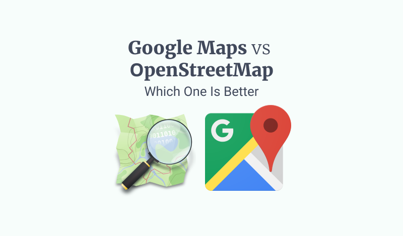
Google Maps and OpenStreetMap are two of the most popular and widely used online mapping platforms. Both offer a range of features and functions that can help you add maps to your WordPress site, but they also have some significant differences. This article will compare Google Maps and OpenStreetMap to help you determine the best choice for your WordPress projects.

We will examine the features and functionality of each platform, compare the user experience, evaluate the accuracy and reliability of the data, and discuss the cost of using each one. By the end of this article, you should better understand the strengths and weaknesses of Google Maps and OpenStreetMap and make an informed decision about the right choice for your WordPress projects.
Features and Functionality
One of the key differences between Google Maps and OpenStreetMap is the type and amount of data and information each platform provides. Google Maps has been around for longer and has a larger team of data editors and contributors, allowing it to build a comprehensive and detailed world map. Google Maps includes information on roads, highways, buildings, businesses, landmarks, etc. It also offers features such as real-time traffic updates, public transit information, and integration with other Google services such as Street View.
On the other hand, OpenStreetMap is a more recent platform created in response to the limited availability of open data in online maps. OpenStreetMap relies on a community of volunteers to contribute and maintain its data, leading to a less comprehensive and detailed world map. However, OpenStreetMap does offer some unique features and functions, such as the ability to download and use the map data for offline use and support for user-generated tags and custom data layers.
Overall, Google Maps offers a more complete and polished mapping experience with a wider range of data and features. However, OpenStreetMap's reliance on open data and community contributions makes it a more flexible and customizable platform for those who need more control over their map data.
Suggested Article: How to Create an Exit Intent Popup in WordPress
User Experience
In addition to the features and functions of each platform, the user experience is also an important factor to consider when choosing between Google Maps and OpenStreetMap.
Google Maps has a clean and intuitive interface, with a simple search bar at the top and easy-to-use controls for zooming and panning the map. Google Maps also offers a range of map styles, from the default road map to satellite and terrain views, which can be helpful for different types of information and uses.
OpenStreetMap has a user-friendly interface with a search bar and basic map navigation controls. However, OpenStreetMap's reliance on community contributions means the map can be less consistent and polished in design and style. For example, the labels and names on the map may be less standardized, and the overall appearance may vary depending on the data contributors in a particular area.
Overall, Google Maps offers a more consistent and polished user experience, with a wider range of map styles and a more intuitive interface. However, OpenStreetMap's customizable and open data approach may appeal to users who want more control over the look and feel of their maps.
Accuracy and Reliability
Regarding the accuracy and reliability of the data and information provided by each platform, there are some key differences between Google Maps and OpenStreetMap.
Google Maps has a team of professional data editors and many contributors, which allows it to maintain high accuracy and consistency in its map data. Google Maps also uses various sources and technologies, such as satellite imagery and street-level photography, to verify and update its data. As a result, Google Maps is generally considered one of the most accurate and reliable online mapping platforms available.
On the other hand, OpenStreetMap relies on a community of volunteers to contribute and maintain its data. While this approach has its advantages, such as the ability to update the map with local knowledge and changes quickly, it also means that the accuracy and reliability of the data can vary depending on the quality and quantity of contributions in a particular area. OpenStreetMap also lacks the professional editing and verification processes that Google Maps has, which can lead to inconsistencies or errors in the map data.
Google Maps is considered more accurate and reliable than OpenStreetMap due to its professional editing and verification processes and larger data and contributors. However, OpenStreetMap's reliance on community contributions and open data can provide a more up-to-date and localized view of the world in some cases.
Suggested Article: How to Open a Popup on Page Load in WordPress
Cost
Another important factor to consider when choosing between Google Maps and OpenStreetMap is the cost of using each platform.
Google Maps is a free service available to anyone with an internet connection. However, certain features and functions are only available to users with a Google account. Some features, such as high-resolution satellite imagery and offline maps, may require a subscription fee.
OpenStreetMap is also a free service that does not require a Google account or any other subscription. OpenStreetMap is supported by donations from users and organizations and is governed by a non-profit foundation.
Overall, both Google Maps and OpenStreetMap are free to use, but Google Maps may require a subscription fee for certain features, while OpenStreetMap is entirely donation-based. Depending on your specific needs and budget, this may be a factor to consider.
Embed OpenStreetMap on your WordPress site
The following step‑by‑step tutorial will help you add OpenStreetMap, either inline on your posts/pages or in a popup on your WordPress site.
Embed the map in a post or page
Want to embed an OpenStreetMap on your WordPress site on a post or page? FireBox built-in Map block helps you do just that. We've prepared a detailed guide here: How to add an OpenStreetMap on your WordPress Site.
Finalize your page changes and publish it! Congratulations! You've now added an OpenStreetMap to your WordPress site.
Embed the map inside a popup
Looking to add an OpenStreetMap as a popup on your WordPress site? You can easily do that with the FireBox built-in Map block! Check out our handy post on how to display an OpenStreetMap popup on your WordPress Site just like you want.
Conclusion
Google Maps offers a more complete and polished mapping experience, with a wider range of data and features and a consistent and user-friendly interface. However, Google Maps may require a subscription fee for certain features and is not as customizable or open as OpenStreetMap.
On the other hand, OpenStreetMap is a more recent platform that relies on community contributions and open data, making it a more flexible and customizable option. OpenStreetMap's open data approach can provide a more up-to-date and localized worldview. Still, the accuracy and reliability of the data may vary depending on the quality and quantity of contributions in a particular area.
The best choice between Google Maps and OpenStreetMap will depend on your specific needs and priorities. If you value a comprehensive and polished mapping experience with a wide range of data and features, then Google Maps may be the right choice. However, if you need more control over your map data or want to support the open data movement, OpenStreetMap may be a better option.
With FireBox, you can captivate your visitors with engaging popups that provide valuable information and create a user-friendly experience. Elevate your WordPress site's functionality and user engagement by combining our Map Gutenberg Block with FireBox.
Get FireBox for Free
Enter your WordPress website URL to install instantly.
Trusted by 9,000+ users


0 Comments